The Glacier's Verdict
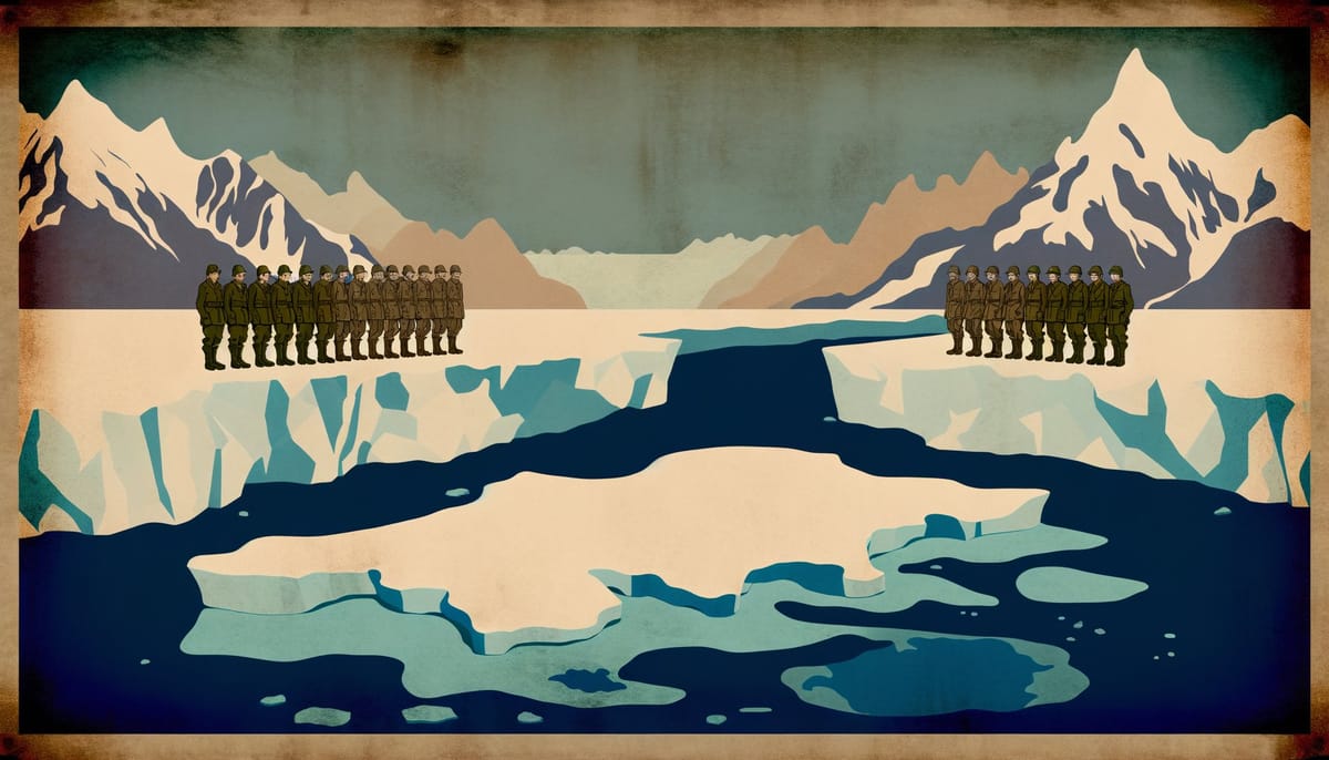
At 4,500 metres in the Depsang Plains, sovereignty dissolves with the permafrost. Chinese and Indian soldiers patrol terrain that is literally disappearing beneath their boots—glaciers retreating, watersheds shifting, the physical geography that once defined borders melting into cartographic...
The Illusion of Lines
The Line of Actual Control is not a line. It is a zone of contested interpretation stretching across 3,488 kilometres of the world’s most forbidding terrain, where neither government agrees on where the boundary lies, and in many sectors, neither has bothered to find out. This deliberate ambiguity served both nations for decades. It no longer does.
The conventional narrative holds that the 2020 Galwan Valley clash—which killed at least 20 Indian and an undisclosed number of Chinese soldiers in medieval hand-to-hand combat—represented a rupture in an otherwise stable relationship. The reality is precisely inverted. Galwan revealed what was always true: the border mechanisms that appeared to manage tensions were managing perceptions, not geography.
Consider the architecture of agreements. The 1993 Border Peace and Tranquility Agreement, the 1996 Confidence Building Measures, the 2005 Political Parameters—each added institutional layers while leaving the fundamental question unanswered: where, exactly, is the border? The agreements succeeded not because they resolved disputes but because they created protocols for pretending disputes did not exist. Patrols operated on “differing perceptions” of the LAC. Incidents were handled through “established mechanisms.” The language itself was designed to obscure.
This worked when both nations had larger priorities. China was focused on economic development and coastal integration with global markets. India was preoccupied with Pakistan and internal consolidation. The Himalayas could remain frozen in strategic amber. Climate change and great-power competition have shattered that equilibrium.
The physical transformation is stark. Glacial retreat is redefining watersheds and mountain passes at rates that outpace military planning cycles. The Siachen Glacier, already the world’s highest battlefield, has lost over 800 metres of ice since monitoring began. Permafrost degradation is destabilising the infrastructure both nations have raced to build. Roads buckle. Helipads crack. The terrain that military doctrine was optimised for is disappearing within deployment timeframes.
More consequentially, climate change has elevated water from background concern to strategic imperative. The Brahmaputra—known as the Yarlung Tsangpo in Tibet—originates on the Chinese-controlled plateau before flowing through India and Bangladesh. Chinese dam construction on the upper reaches has given Beijing a lever it has never explicitly threatened to pull but cannot credibly promise not to. India’s downstream vulnerability transforms every border negotiation into an implicit water negotiation. The Himalayas are not just contested territory; they are contested hydrology.
The Metabolic Trap
The human cost of high-altitude confrontation is poorly understood and rarely discussed. At 5,000 metres, the body requires 5,000 to 7,000 calories daily merely to survive—approaching the maximum sustainable human intake. Any additional exertion for combat, patrolling, or construction pushes soldiers into caloric deficit that compounds daily. Cognitive function degrades measurably: ascending from 1,000 to 4,000 metres produces effects equivalent to aging 25 years in specific neurological measures. Reaction times slow. Memory formation impairs. Vigilance—the foundation of defensive posture—erodes continuously.
This creates what might be called the metabolic trap. Both nations have invested massively in forward infrastructure precisely because they cannot sustain large forces at altitude without it. China’s “Xiaokang” border villages and India’s Border Roads Organisation projects represent attempts to create permanent presence in terrain that actively resists human habitation. Yet each road, each helipad, each garrison accelerates groundwater depletion in cold arid ecosystems, undermining the hydrological basis for the very settlements they support.
The military mathematics are brutal. India maintains approximately 200,000 troops oriented toward the China border. China’s Western Theatre Command can draw on larger numbers but faces its own logistical constraints projecting force onto the Tibetan Plateau. Neither side can achieve decisive superiority without mobilisation that would be detected months in advance. Both have optimised for a war neither can win quickly.
The result is a permanent low-grade confrontation that consumes resources, degrades equipment, and erodes personnel at rates neither military publicly acknowledges. Soldiers rotate through high-altitude postings on calendar schedules that ignore neurological reality. Institutional knowledge bleeds away as experienced troops cycle out before they can transfer hard-won expertise to replacements whose cognitive capacity is already compromised by altitude. The border does not need to erupt into war to exact its toll.
Two Clocks, One Mountain
The deepest obstacle to resolution is not territorial but temporal. China and India operate on fundamentally incompatible timescales, and neither can perceive the other’s clock.
China’s strategic culture is shaped by what it calls the “Century of Humiliation”—the period from the Opium Wars to the Communist victory in 1949 when foreign powers carved up Chinese sovereignty. This is not history in the Western sense of events receding into irrelevance. It is founding mythology, continuously reinforced through education, media, and official discourse. The McMahon Line, drawn by British India in 1914 without meaningful Chinese participation, is experienced not as a colonial-era boundary requiring pragmatic adjustment but as an open wound requiring rectification.
Beijing’s territorial claims have expanded, not contracted, over time. In 2006, China escalated from claiming the Tawang Tract to asserting sovereignty over all of Arunachal Pradesh—a state of 1.4 million Indian citizens. The 2008 introduction of stapled visas for Arunachali residents was not a negotiating tactic but an ontological claim: these people are already Chinese, whether they know it or not. Each cartographic assertion creates new facts that subsequent Chinese leaders inherit as baseline.
India’s temporal orientation is more fractured. The strategic establishment operates on electoral cycles and coalition politics. The military plans on equipment procurement timelines stretching decades. Hindu nationalist discourse invokes civilisational continuity measured in millennia while simultaneously embracing modernisation narratives of urgent transformation. There is no unified Indian clock—only competing rhythms that align briefly during crises before diverging again.
This temporal incommensurability makes negotiation structurally difficult. When Indian officials propose “status quo” arrangements, they mean freezing current positions. When Chinese officials hear “status quo,” they hear acceptance of illegitimate colonial impositions. When China demands “historical” boundaries, India hears territorial revisionism. The same words carry incompatible meanings.
The October 2024 disengagement agreement, which restored patrolling rights at Depsang and Demchok, was celebrated as a breakthrough. It was nothing of the sort. It returned both sides to positions they held before 2020 without addressing why those positions proved unstable. The underlying dynamic—mutual suspicion, infrastructure competition, incompatible sovereignty claims—remains unchanged. The agreement bought time. It did not buy resolution.
The Economic Paradox
Trade between China and India exceeded $118 billion in 2024, with India running a deficit approaching $100 billion. This asymmetric interdependence is supposed to constrain conflict. It does the opposite.
India depends on Chinese imports for electronics, pharmaceuticals, and renewable energy components in ways that cannot be quickly unwound. The “Production Linked Incentive” schemes designed to reduce this dependency have achieved modest success in mobile phone assembly while leaving deeper supply chain vulnerabilities untouched. When Indian officials banned Chinese apps after Galwan, they discovered that Indian alternatives ran on Chinese infrastructure. The entanglement is architectural, not transactional.
China’s economic leverage over India is substantial but difficult to weaponise without cost. Restricting exports would accelerate Indian decoupling efforts and invite retaliation against Chinese investments across South and Southeast Asia. More importantly, economic coercion would validate India’s strategic alignment with the United States and its partners—precisely the outcome Beijing seeks to prevent.
The result is mutual constraint that neither side experiences as stabilising. India feels vulnerable to Chinese economic pressure and resents the dependency. China feels entitled to economic deference and resents Indian resistance. Trade has not created peace constituencies in either capital; it has created grievance constituencies convinced the other side is exploiting the relationship.
The Quad—the informal grouping of the United States, Japan, Australia, and India—compounds Beijing’s anxieties. Chinese strategists view India’s deepening security cooperation with Washington as encirclement by another name. Indian strategists view Chinese opposition to the Quad as confirmation that Beijing seeks regional hegemony. Each side’s defensive moves validate the other’s threat perceptions. The security dilemma operates with textbook precision.
The Violence That Speaks
The Galwan clash deserves closer examination, not for its immediate causes but for what it revealed about the conflict’s grammar.
Both sides observed an informal agreement prohibiting firearms at the LAC. When violence erupted, soldiers fought with clubs, stones, and nail-studded batons. Twenty Indians died. China initially disclosed no casualties, then acknowledged four deaths seven months later. External estimates suggest Chinese losses were considerably higher.
This was not primitive violence born of inadequate equipment. It was ritualised violence operating under shared constraints that neither side had formally negotiated. The no-firearms norm emerged organically from decades of patrol encounters, each side recognising that escalation to shooting would trigger dynamics neither could control. The violence at Galwan was brutal but bounded—a grammar of conflict that communicated resolve without crossing thresholds.
China’s delayed casualty disclosure was equally communicative. By refusing to acknowledge deaths for months, Beijing prevented the formation of reciprocal blood-debt obligations that would have demanded response. India’s immediate public mourning transformed its soldiers into national martyrs, channelling nationalist rage into ritual commemoration rather than retaliatory pressure. Both societies processed the violence through cultural mechanisms that contained rather than amplified escalation.
This is not reassuring. It suggests the conflict has developed its own logic—a set of unwritten rules that permit violence while constraining its scope. Such rules can stabilise confrontation for extended periods. They can also fail catastrophically when one side miscalculates the other’s red lines or when domestic pressures demand escalation beyond ritual bounds.
The Tawang clash of December 2022, in which Indian and Chinese troops again fought hand-to-hand, demonstrated both the resilience and fragility of these constraints. The violence remained non-lethal. But it occurred in a sector India considers non-negotiable—the birthplace of the sixth Dalai Lama and gateway to the Tibetan Buddhist world. Each encounter in the eastern sector carries symbolic weight that Ladakh does not.
The Default Trajectory
Without significant intervention, the China-India conflict will follow a predictable path: episodic crises separated by periods of armed coexistence, with each crisis leaving behind more infrastructure, more troops, and less room for de-escalation.
The infrastructure race is self-reinforcing. Every Chinese road built toward the LAC demands an Indian response. Every Indian airbase constructed within striking distance of Tibet requires Chinese countermeasures. Neither side can accept permanent disadvantage; neither can achieve permanent advantage. The competition consumes resources that both nations need for development while producing capabilities that increase the costs of any eventual conflict.
Climate change will accelerate instability. As glaciers retreat and water stress intensifies, the strategic value of Himalayan territory will increase even as the human cost of holding it rises. Disputes that once seemed abstract—control of a ridge, access to a patrol point—will acquire existential stakes as downstream populations face water scarcity.
Domestic politics in both nations trend toward nationalism that constrains diplomatic flexibility. Xi Jinping has staked regime legitimacy on China’s “national rejuvenation,” a project that cannot accommodate territorial concessions. Indian political competition increasingly rewards anti-China posturing across party lines. Leaders who might prefer accommodation face constituencies that would punish it.
The nuclear dimension, rarely discussed, lurks beneath every scenario. Both nations possess thermonuclear weapons and the means to deliver them. India’s no-first-use doctrine and China’s minimum deterrence posture are meant to reassure. They also mean that any conventional conflict would occur in the shadow of nuclear escalation, with neither side certain where the other’s thresholds lie.
What Leverage Exists
Three intervention points could alter the trajectory. None is likely to be seized.
First, water-sharing agreements could transform the Brahmaputra from source of vulnerability into framework for cooperation. China has resisted binding commitments, preferring to maintain optionality. India has been reluctant to acknowledge dependence that formalising arrangements would reveal. A genuine water compact—with monitoring mechanisms, data sharing, and dispute resolution procedures—would require both nations to accept constraints they have thus far rejected. The prize would be substantial: removing water from the list of crisis accelerants and creating institutional channels that might spill over into other domains.
Second, a boundary settlement in the western sector could trade Indian acceptance of Chinese control over Aksai Chin—territory India claims but has never administered—for Chinese recognition of the McMahon Line in the east. This “swap” has been discussed for decades. It founders on the same asymmetry that afflicts all negotiations: India would be conceding territory it lost in 1962, while China would be accepting a colonial-era boundary it has never recognised. Neither domestic audience would accept the trade as presented. Creative formulations might thread this needle, but creativity requires political capital that neither leader has shown willingness to spend.
Third, external mediation could provide face-saving mechanisms that direct negotiation cannot. The United States, despite its strategic interest in India, lacks credibility with Beijing. Russia, despite its relationships with both, lacks leverage over either. The most plausible mediator—some combination of ASEAN states with interests in regional stability—has neither the capacity nor the inclination to insert itself into great-power rivalry.
The most likely scenario is therefore continuation: more infrastructure, more patrols, more incidents, more agreements that manage symptoms without addressing causes. Both nations will invest heavily in a confrontation that neither wants to fight and neither can afford to lose. The Himalayas will continue their slow transformation, indifferent to the flags planted on their slopes.
The Mountain’s Indifference
In Ladakh’s cold desert, Indian and Chinese soldiers face each other across terrain that is actively rejecting their presence. Groundwater tables fall. Permafrost destabilises. The glaciers that once defined boundaries retreat toward oblivion. Both nations have committed to holding ground that the earth itself is withdrawing.
This is the China-India conflict’s deepest truth: it is a quarrel over geography that geography is rendering moot. The lines that matter—watersheds, aquifers, viable human habitat—are moving faster than diplomats can negotiate or soldiers can patrol. The conflict’s trajectory is not toward resolution or war but toward a permanent state of armed obsolescence, two great powers contesting territory that may not sustain the contest.
The tragedy is that both nations know this. The strategic literature in Delhi and Beijing acknowledges climate pressures, resource constraints, and the costs of confrontation. The knowledge changes nothing. Domestic politics, historical grievance, and institutional momentum carry both nations forward into a future neither would choose but neither can escape.
The glacier does not care who claims it. It is leaving regardless.